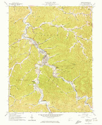
1962 Map of Madison
USGS Topo · Published 1974About this map
Madison and neighboring Danville serve as the focal points of this mid-century survey, situated at the confluence of the Little Coal River and its major forks. The landscape is defined by the heavy presence of the natural gas industry, with extensive Gas Fields and Pipelines crisscrossing the ridges between Workman Knob and Price Hill. Transport and commerce follow the narrow valley floors, dominated by the Chesapeake and Ohio railroad which services settlements like Uneeda, Quinland, and South Madison. Genealogists will find a dense concentration of family landmarks, including the Ballard Cem, Miller Cem, and Vandelinde Cem. The era's local culture is visible in features like the Drive-in Theater near Rock Creek and the Athletic Field and Golf Course near the river bends, reflecting a period of established industrial and community growth in Boone County.
Find a feature on this map
100 named features on this map. Tap any name to fly to it.
Don’t see what you’re looking for? This feature index may not catch every label — zoom into the map to look around manually.
Map Details
Editions of this 1962 Madison Map
4 editions found
Other maps of this area

1891 · Oceana
USGS Topo · 1:125,000

1893 · Oceana
USGS Topo · 1:125,000

1898 · Oceana
USGS Topo · 1:125,000

1899 · Charleston
USGS Topo · 1:125,000

1909 · Peytona
USGS Topo · 1:48,000

1910 · Bald Knob
USGS Topo · 1:48,000

1911 · Peytona
USGS Topo · 1:62,500

1911 · Madison
USGS Topo · 1:62,500

1912 · Bald Knob
USGS Topo · 1:62,500

1913 · Logan
USGS Topo · 1:62,500