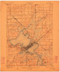
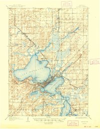
1906 Map of Madison
USGS Topo · Published 1910About this map
Madison is defined by its dramatic isthmus setting at the start of the 20th century, anchored by the sprawling University of Wisconsin campus on the shores of Lake Mendota. This survey illustrates a period of significant regional development, where the capital city serves as a central hub for five distinct railroad lines, including the Chicago and Northwestern RR and the Illinois Central RR. Beyond the urban core, the landscape features institutional landmarks like the State Hospital for the Insane at Mendota and the State Fish Hatchery to the south.
Find a feature on this map
68 named features on this map. Tap any name to fly to it.
Don’t see what you’re looking for? This feature index may not catch every label — zoom into the map to look around manually.
Map Details
Editions of this 1906 Madison Map
6 editions found

Other maps of this area

1889 · Evansville
USGS Topo · 1:62,500

1890 · Madison
USGS Topo · 1:62,500

1890 · Sun Prairie
USGS Topo · 1:62,500

1890 · Stoughton
USGS Topo · 1:62,500

1892 · Madison
USGS Topo · 1:62,500

1894 · Evansville
USGS Topo · 1:62,500

1895 · Baraboo
USGS Topo · 1:62,500

1896 · Sun Prairie
USGS Topo · 1:62,500

1901 · Poynette
USGS Topo · 1:62,500

1904 · Madison
USGS Topo · 1:62,500