
1957 Map of Madison
USGS Topo · Published 1967About this map
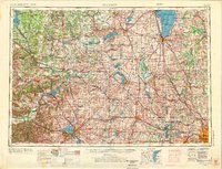
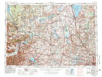
The Wisconsin River and Rock River systems anchor this mid-century landscape, a region transitioning from its agricultural foundations toward post-war industrial expansion. The map captures the complex water networks of south-central Wisconsin, including the expansive Lake Winnebago and the cluster of lakes surrounding Madison, such as Lake Mendota and Lake Monona. A major landmark of the era is the Badger Ordnance Works, a massive wartime industrial facility located between Baraboo and the river.
Find a feature on this map
143 named features on this map. Tap any name to fly to it.
Don’t see what you’re looking for? This feature index may not catch every label — zoom into the map to look around manually.
Map Details
Editions of this 1957 Madison Map
3 editions found
Other maps of this area

1889 · Evansville
USGS Topo · 1:62,500

1890 · Madison
USGS Topo · 1:62,500

1890 · Sun Prairie
USGS Topo · 1:62,500

1890 · Stoughton
USGS Topo · 1:62,500

1891 · Waterloo
USGS Topo · 1:62,500

1891 · Koshkonong
USGS Topo · 1:62,500

1891 · Bayview
USGS Topo · 1:62,500

1891 · Muskego
USGS Topo · 1:62,500

1892 · Milwaukee
USGS Topo · 1:62,500

1892 · Waukesha
USGS Topo · 1:62,500