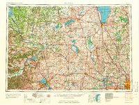
1960 Map of Madison
USGS Topo · Published 1960About this map
The Wisconsin River carves through the heart of this landscape, anchoring the historic canal point at Portage. This mid-century survey illustrates the interconnected water systems of central and southern Wisconsin, where the Fox River and Rock River drainages meet. The state capital, Madison, is clearly defined by its position on the isthmus between Lake Mendota and Lake Monona, surrounded by the emerging suburbs of Middleton, Shorewood Hills, and Monona.
Find a feature on this map
288 named features on this map. Tap any name to fly to it.
Don’t see what you’re looking for? This feature index may not catch every label — zoom into the map to look around manually.
Map Details
Editions of this 1960 Madison Map
2 editions found

Other maps of this area

1889 · Evansville
USGS Topo · 1:62,500

1890 · Madison
USGS Topo · 1:62,500

1890 · Sun Prairie
USGS Topo · 1:62,500

1890 · Stoughton
USGS Topo · 1:62,500

1891 · Waterloo
USGS Topo · 1:62,500

1891 · Koshkonong
USGS Topo · 1:62,500

1891 · Bayview
USGS Topo · 1:62,500

1891 · Muskego
USGS Topo · 1:62,500

1892 · Milwaukee
USGS Topo · 1:62,500

1892 · Waukesha
USGS Topo · 1:62,500