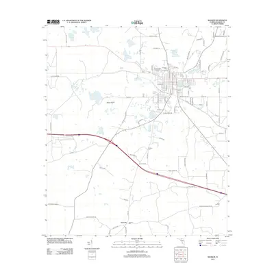
2012 Map of Madison
USGS Topo · Published 2012About this map
Francis Lake and the academic grounds of North Florida Community College anchor the north-central portion of this landscape, representing the modern core of the area. The surrounding terrain is defined by a high density of small water bodies and wetlands, including Livingston Springs, Rachel Lake, and the expansive Messer Prairie. This concentration of surface water suggests a karst topography characteristic of the region, where sinkhole lakes and springs dictate the layout of roads and settlements.
Find a feature on this map
88 named features on this map. Tap any name to fly to it.
Don’t see what you’re looking for? This feature index may not catch every label — zoom into the map to look around manually.
Map Details
Editions of this 2012 Madison Map
This is the sole edition of this map. No revisions or reprints were ever made.
Other maps of this area

1954 · Greenville NE
USGS Topo · 1:24,000

1954 · Valdosta
USGS Topo · 1:250,000

1955 · Greenville SE
USGS Topo · 1:24,000

1958 · Valdosta
USGS Topo · 1:250,000

1958 · Madison SW
USGS Topo · 1:24,000

1958 · Madison SE
USGS Topo · 1:24,000

1958 · Lee
USGS Topo · 1:24,000

1959 · Valdosta
USGS Topo · 1:250,000

1959 · Madison
USGS Topo · 1:24,000

1960 · Cherry Lake
USGS Topo · 1:24,000