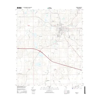
2015 Map of Madison
USGS Topo · Published 2015About this map
Madison serves as the central hub of this North Florida landscape, where the grid of city streets transitions into a countryside defined by an intricate network of ponds and wetlands. The local educational presence is anchored by the N Florida Community Coll on the western edge of town. Surrounding the settlement, the geography is punctuated by numerous named water bodies such as Francis Lake, Rachel Lake, and the cluster of Mill Pond, Brickyard Pond, and Mays Pond to the east.
Find a feature on this map
114 named features on this map. Tap any name to fly to it.
Don’t see what you’re looking for? This feature index may not catch every label — zoom into the map to look around manually.
Map Details
Editions of this 2015 Madison Map
This is the sole edition of this map. No revisions or reprints were ever made.
Other maps of this area

1954 · Greenville NE
USGS Topo · 1:24,000

1954 · Valdosta
USGS Topo · 1:250,000

1955 · Greenville SE
USGS Topo · 1:24,000

1958 · Valdosta
USGS Topo · 1:250,000

1958 · Madison SW
USGS Topo · 1:24,000

1958 · Madison SE
USGS Topo · 1:24,000

1958 · Lee
USGS Topo · 1:24,000

1959 · Valdosta
USGS Topo · 1:250,000

1959 · Madison
USGS Topo · 1:24,000

1960 · Cherry Lake
USGS Topo · 1:24,000