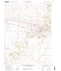
1970 Map of Mahomet
USGS Topo · Published 1976About this map
The Sangamon River winds through central Illinois, shaping the landscape near Mahomet as it was documented in the mid-1970s. This survey illustrates the early expansion of the Lake of the Woods Park, a significant local recreational site featuring a Museum and a Covered Bridge. The transition from agricultural land to utility and preservation is evident in the sprawling Mahomet Gas Storage Area and numerous Gravel Pits along the riverbanks. For genealogists, the map is particularly rich, locating several family and community burial grounds such as Dunkard Cem, Argo Cem, and Seymour Cem. The Penn Central corridor serves as the primary east-west artery, connecting the larger settlement at Mahomet with smaller outlying points like Centerville.
Find a feature on this map
30 named features on this map. Tap any name to fly to it.
Don’t see what you’re looking for? This feature index may not catch every label — zoom into the map to look around manually.
Map Details
Editions of this 1970 Mahomet Map
3 editions found
Other maps of this area

1907 · Mahomet
USGS Topo · 1:62,500

1928 · Gibson City
USGS Topo · 1:62,500

1937 · Monticello
USGS Topo · 1:48,000

1943 · Monticello
USGS Topo · 1:62,500

1952 · Arrowsmith
USGS Topo · 1:62,500

1957 · Gibson City
USGS Topo · 1:62,500

1957 · Rising
USGS Topo · 1:24,000

1957 · Mahomet
USGS Topo · 1:62,500

1957 · Bondville
USGS Topo · 1:24,000

1958 · Peoria
USGS Topo · 1:250,000