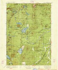
1934 Map of Maiden Peak
USGS Topo · Published 1934About this map
Maiden Peak and the high volcanic terrain of the Cascades dominate this 1930s landscape, an era when the region was defined by forest management and emerging infrastructure. The map reveals a network of government outposts, including the Crane Prairie Guard Sta, Rosland Guard Sta, and Davis Creek Guard Sta, which were essential for overseeing these timberlands before modern automation. Settlement is sparse, represented by isolated outposts like Caldwell Ranch and Graft Ranch, while the village of Lapine serves as a primary hub along the Southern Pacific railroad line.
Find a feature on this map
130 named features on this map. Tap any name to fly to it.
Don’t see what you’re looking for? This feature index may not catch every label — zoom into the map to look around manually.
Map Details
Editions of this 1934 Maiden Peak Map
3 editions found
Other maps of this area

1917 · Diamond Lake
USGS Topo · 1:125,000

1925 · Waldo Lake
USGS Topo · 1:125,000

1926 · Bend
USGS Topo · 1:125,000

1929 · Bend
USGS Topo · 1:125,000

1929 · Three Sisters
USGS Topo · 1:125,000

1930 · Maiden Peak
USGS Topo · 1:125,000

1931 · Newberry Crater
USGS Topo · 1:125,000

1932 · Three Sisters
USGS Topo · 1:125,000

1934 · Maiden Peak
USGS Topo · 1:125,000

1934 · Mc Kenzie Bridge
USGS Topo · 1:96,000