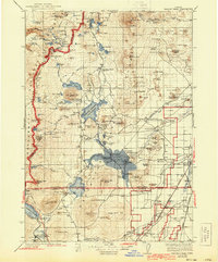
1934 Map of Maiden Peak
USGS Topo · Published 1944About this map
The high lava plains and cascading waters of the upper Deschutes River basin define this mid-century landscape. This survey documents a critical era of water management and forest service infrastructure, featuring the early configurations of the Crane Prairie Reservoir and the developing Wickiup Reservoir. The map illustrates a network of remote outposts necessary for managing the wilderness, including the Fall River Guard Sta and Deschutes Bridge Guard Sta, alongside localized industry at the Fish Hatchery and Pringle Falls.
Find a feature on this map
137 named features on this map. Tap any name to fly to it.
Don’t see what you’re looking for? This feature index may not catch every label — zoom into the map to look around manually.
Map Details
Editions of this 1934 Maiden Peak Map
3 editions found
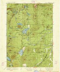
Other maps of this area

1917 · Diamond Lake
USGS Topo · 1:125,000

1925 · Waldo Lake
USGS Topo · 1:125,000

1926 · Bend
USGS Topo · 1:125,000

1929 · Bend
USGS Topo · 1:125,000

1929 · Three Sisters
USGS Topo · 1:125,000

1930 · Maiden Peak
USGS Topo · 1:125,000

1931 · Newberry Crater
USGS Topo · 1:125,000

1932 · Three Sisters
USGS Topo · 1:125,000

1934 · Maiden Peak
USGS Topo · 1:125,000

1934 · Mc Kenzie Bridge
USGS Topo · 1:96,000