
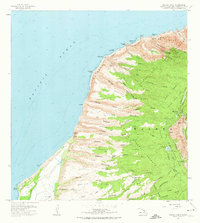
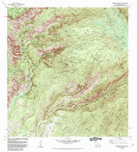
1965 Map of Makaha Point
USGS Topo · Published 1967About this map
The Na Pali Coast of Kauai is revealed in this 1960s survey as a landscape defined by dramatic verticality and deep-cut valleys. Ancient cultural sites such as Polihale Heiau and Kapaula Heiau are recorded along the coastal terrace, anchoring the region's indigenous history. Inland, the topography transitions from the high ridges of Milolii Ridge and Makaha Ridge down to the coastal plains of Barking Sands, where the Auxiliary Landing Field Bonham signifies mid-century military infrastructure. Local water management is visible through the Lua Reservoir and a network of ditches and wells supporting the nearby settlements of Mana and Saki Mana. The map also captures the early preservation of the island's natural wonders within the boundaries of Milolii State Park and Kokee State Park, preserving a detailed look at the island's traditional land divisions and remote trail systems.
Find a feature on this map
83 named features on this map. Tap any name to fly to it.
Don’t see what you’re looking for? This feature index may not catch every label — zoom into the map to look around manually.
Map Details
Editions of this 1965 Makaha Point Map
2 editions found
Other maps of this area

1954 · Kauai
USGS Topo · 1:250,000

1963 · Kekaha
USGS Topo · 1:24,000

1965 · Waimea Canyon
USGS Topo · 1:24,000

1965 · Haena
USGS Topo · 1:24,000

1967 · Kauai
USGS Topo · 1:250,000

1970 · Kauai
USGS Topo · 1:250,000
1983 · Haena
USGS Topo · 1:24,000
1983 · Makaha Point
USGS Topo · 1:24,000
1983 · Kekaha
USGS Topo · 1:24,000
1983 · Waimea Canyon
USGS Topo · 1:24,000