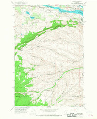
1966 Map of Malaga
USGS Topo · Published 1968About this map
The Columbia River forms the northern boundary of this mid-1960s survey, where the Great Northern railroad tracks parallel the water alongside the settlement of Malaga. The landscape rises sharply from the river valley toward the prominent Jumpoff Ridge, a geological divide that separates the riverfront industry from the rugged hinterlands of the Colockum Research Unit Washington State University. This area demonstrates a mix of agricultural and industrial utility, featuring infrastructure such as the Keokuk Substation and Valhala Substation, alongside numerous irrigation and utility markers including a significant Pipeline and various Gravel Pits. Deep canyons like Kingsbury Canyon and Walker Canyon carve through the terrain, illustrating the complex drainage patterns feeding into Colockum Creek as the elevation climbs toward the Chelan and Kittitas County borders.
Find a feature on this map
38 named features on this map. Tap any name to fly to it.
Don’t see what you’re looking for? This feature index may not catch every label — zoom into the map to look around manually.
Map Details
Editions of this 1966 Malaga Map
2 editions found
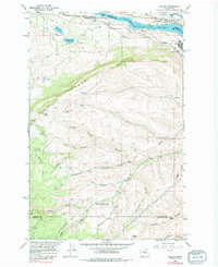
Other maps of this area

1912 · Malaga
USGS Topo · 1:48,000

1913 · Wenatchee
USGS Topo · 1:62,500

1914 · Malaga
USGS Topo · 1:62,500

1915 · Wenatchee
USGS Topo · 1:62,500

1920 · Colockum Pass
USGS Topo · 1:125,000

1922 · Colockum Pass
USGS Topo · 1:125,000

1957 · Wenatchee
USGS Topo · 1:250,000
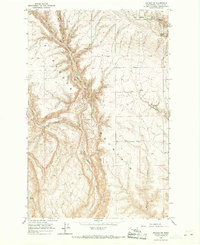
1966 · Malaga NE
USGS Topo · 1:24,000

1966 · Rock Island
USGS Topo · 1:24,000

1966 · Wenatchee
USGS Topo · 1:24,000