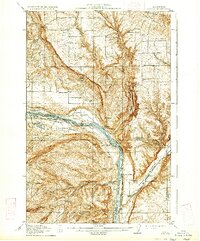
1914 Map of Malaga
USGS Topo · Published 1934About this map
The Columbia River serves as the central artery for this region, carving a deep canyon through the plateau as it flows past the settlement of Malaga. This 1914 survey, reprinted in 1934, documents a landscape transitioning toward industrial development, most notably marked by the Rock Island Dam. The presence of numerous district schoolhouses, such as Columbia Heights School, Liberty School, and Valhalla School, reflects a distributed agricultural population during the early twentieth century. Transportation is dominated by the Great Northern railroad, which follows the river's path, and the Ellensburg Road, connecting the river valley to the surrounding uplands.
Find a feature on this map
40 named features on this map. Tap any name to fly to it.
Don’t see what you’re looking for? This feature index may not catch every label — zoom into the map to look around manually.
Map Details
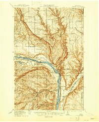
Editions of this 1914 Malaga Map
3 editions found
Other maps of this area

1901 · Chelan
USGS Topo · 1:125,000

1909 · Quincy
USGS Topo · 1:62,500

1910 · Quincy
USGS Topo · 1:62,500

1912 · Malaga
USGS Topo · 1:48,000

1913 · Wenatchee
USGS Topo · 1:62,500

1914 · Malaga
USGS Topo · 1:62,500

1915 · Wenatchee
USGS Topo · 1:62,500

1920 · Colockum Pass
USGS Topo · 1:125,000

1922 · Colockum Pass
USGS Topo · 1:125,000

1953 · Ritzville
USGS Topo · 1:250,000