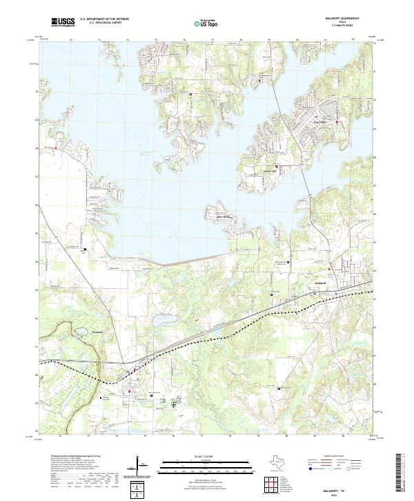
2022 Map of Malakoff
USGS Topo · Published 2022About this map
The sprawling shoreline of Cedar Creek Reservoir dominates the landscape north of Malakoff, where residential communities like Caney City, Log Cabin, and Star Harbor define the modern waterfront. The southern portion of the map transitions into the river bottomlands where Cedar Creek and McAllister Slough approach the Trinity River. Here, the industrial character of Trinidad is evident near Trinidad Lake, situated along the Navarro Co and Henderson Co line.
Find a feature on this map
158 named features on this map. Tap any name to fly to it.
Don’t see what you’re looking for? This feature index may not catch every label — zoom into the map to look around manually.
Map Details
Editions of this 2022 Malakoff Map
This is the sole edition of this map. No revisions or reprints were ever made.
Other maps of this area

1920 · Kemp
USGS Topo · 1:62,500

1948 · Martins Mill
USGS Topo · 1:62,500

1949 · Martins Mill
USGS Topo · 1:62,500

1949 · Athens
USGS Topo · 1:62,500

1950 · Athens
USGS Topo · 1:62,500

1954 · Dallas
USGS Topo · 1:250,000

1956 · Tyler
USGS Topo · 1:250,000

1957 · Kemp
USGS Topo · 1:62,500

1958 · Dallas
USGS Topo · 1:250,000

1960 · Tool
USGS Topo · 1:24,000