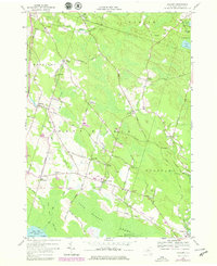
1957 Map of Mallory
USGS Topo · Published 1978About this map
Oneida Lake and the wetlands of Toad Harbor Swamp and Big Bay Swamp anchor this 1950s survey of southern Oswego County. The landscape is defined by the legacy of early 19th-century immigration, visible in the concentrated clusters of Little France, Dutch Settlement, and Mud Settlement. These hamlets, along with Union Settlement, reflect a period where distinct ethnic enclaves established tight-knit agricultural communities. The terrain transitions from the low-lying marshlands of Big Bay to the elevated ground at Whig Hill and The Pinnacle. Transportation is a key feature, showing the Conrail line and the transition from traditional through-fares like Gulf Bridge Road to the modernizing influence of the nearby highway system. Local genealogists will find value in the specific placement of the Little France Cem, Ingersoll Cem, and the cluster of homes at Potter Corners.
Find a feature on this map
68 named features on this map. Tap any name to fly to it.
Don’t see what you’re looking for? This feature index may not catch every label — zoom into the map to look around manually.
Map Details
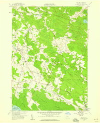
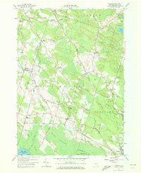
Editions of this 1957 Mallory Map
Other maps of this area

1895 · Chittenango
USGS Topo · 1:62,500

1895 · Syracuse
USGS Topo · 1:62,500

1898 · Syracuse
USGS Topo · 1:62,500

1898 · Chittenango
USGS Topo · 1:62,500

1902 · Chittenango
USGS Topo · 1:62,500

1905 · Mexico
USGS Topo · 1:62,500

1906 · Kasoag
USGS Topo · 1:62,500

1940 · Brewerton
USGS Topo · 1:24,000

1940 · Cicero
USGS Topo · 1:24,000

1941 · Cleveland
USGS Topo · 1:24,000