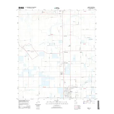
2015 Map of Mamou
USGS Topo · Published 2015About this map
Mamou anchors this south Louisiana landscape, where the flat coastal plain is intricately carved by winding waterways like E Fork Bayou Nezpique and Grand Louis Bayou. This 2015 update illustrates a region defined by agricultural hubs and small crossroads settlements such as Reddell, Vidrine, and Easton. The density of cemeteries, including Ardoin Cem, Ortego Cem, and Platin Cem, provides a significant inventory for genealogical research, often located near longstanding family-named routes such as Narcisse Rd and Felicien Rd. Local infrastructure is marked by the Central Farmers Coop Airport, reflecting the area's ongoing reliance on aviation for industrial farming. The grid-like patterns of rural roads contrast with the natural meandering of Boggy Bayou and Beacons Gully, showing how modern transport networks have adapted to the traditional drainage patterns of Evangeline Parish.
Find a feature on this map
109 named features on this map. Tap any name to fly to it.
Don’t see what you’re looking for? This feature index may not catch every label — zoom into the map to look around manually.
Map Details
Editions of this 2015 Mamou Map
This is the sole edition of this map. No revisions or reprints were ever made.
Other maps of this area

1935 · Beaver
USGS Topo · 1:31,680

1935 · Turkey Creek
USGS Topo · 1:62,500

1942 · Oakdale
USGS Topo · 1:62,500

1947 · Ville Platte
USGS Topo · 1:31,680

1947 · Fruge Lake
USGS Topo · 1:31,680

1947 · Redland
USGS Topo · 1:31,680

1947 · Chataignier
USGS Topo · 1:31,680

1947 · Bond
USGS Topo · 1:31,680

1949 · Turkey Creek
USGS Topo · 1:62,500

1952 · Lake Charles
USGS Topo · 1:250,000