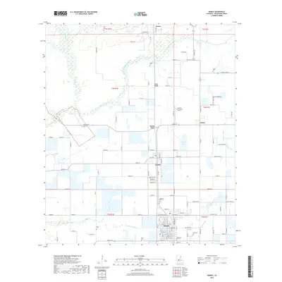
2018 Map of Mamou
USGS Topo · Published 2018About this map
Mamou and the surrounding prairie of Evangeline Parish serve as the focal point for this landscape defined by agricultural drainage and family heritage. The town's grid is anchored by the dual presence of Saint Anns Old Cem and Saint Anns New Cem, while the outlying areas are dotted with smaller family burial grounds such as Ardoin Cem, Perron Cem, and Ortego Cem. These sites, along with the Community Cem, provide significant markers for genealogical research in this Acadiana region.
Find a feature on this map
123 named features on this map. Tap any name to fly to it.
Don’t see what you’re looking for? This feature index may not catch every label — zoom into the map to look around manually.
Map Details
Editions of this 2018 Mamou Map
This is the sole edition of this map. No revisions or reprints were ever made.
Other maps of this area

1935 · Beaver
USGS Topo · 1:31,680

1935 · Turkey Creek
USGS Topo · 1:62,500

1942 · Oakdale
USGS Topo · 1:62,500

1947 · Ville Platte
USGS Topo · 1:31,680

1947 · Fruge Lake
USGS Topo · 1:31,680

1947 · Redland
USGS Topo · 1:31,680

1947 · Chataignier
USGS Topo · 1:31,680

1947 · Bond
USGS Topo · 1:31,680

1949 · Turkey Creek
USGS Topo · 1:62,500

1952 · Lake Charles
USGS Topo · 1:250,000