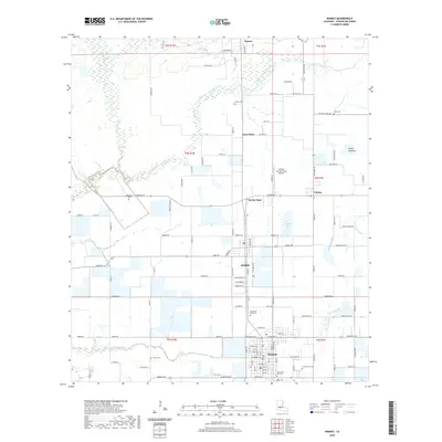
2020 Map of Mamou
USGS Topo · Published 2020About this map
Mamou serves as the primary hub of this Evangeline Parish landscape, where the grid of the town site contrasts with the sprawling Prairie Mamou to the east. The area is defined by its deep agricultural and cemetery history, with numerous family and parish grounds including Ardoin Cem, Perron Cem, and both the Saint Anns Old Cem and Saint Anns New Cem located near the town center. To the north, the small settlements of Reddell, Vidrine, and Barber Spur trace the historical transportation corridors that supported the local economy. The drainage of the land is shaped by the East Fork Bayou Nezpique and Grand Louis Bayou, which wind through the low-lying sections of the terrain. Aviation interest is noted at the Central Farmers Coop Airport, reflecting the industrial and agricultural integration of the mid-to-late 20th century.
Find a feature on this map
110 named features on this map. Tap any name to fly to it.
Don’t see what you’re looking for? This feature index may not catch every label — zoom into the map to look around manually.
Map Details
Editions of this 2020 Mamou Map
This is the sole edition of this map. No revisions or reprints were ever made.
Other maps of this area

1935 · Beaver
USGS Topo · 1:31,680

1935 · Turkey Creek
USGS Topo · 1:62,500

1942 · Oakdale
USGS Topo · 1:62,500

1947 · Ville Platte
USGS Topo · 1:31,680

1947 · Fruge Lake
USGS Topo · 1:31,680

1947 · Redland
USGS Topo · 1:31,680

1947 · Chataignier
USGS Topo · 1:31,680

1947 · Bond
USGS Topo · 1:31,680

1949 · Turkey Creek
USGS Topo · 1:62,500

1952 · Lake Charles
USGS Topo · 1:250,000