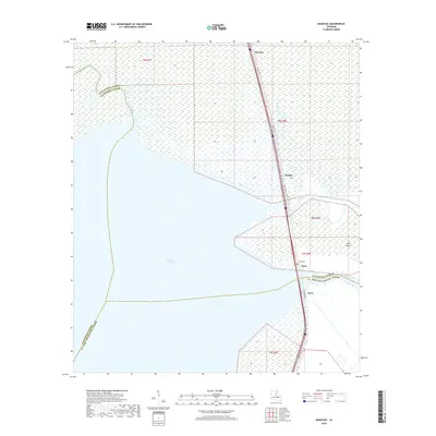
2018 Map of Manchac
USGS Topo · Published 2018About this map
The expansive waters of Lake Maurepas dominate the western portion of this coastal Louisiana landscape, where the convergence of the Tickfaw River and Natalbany River marks the transition into the swampy lowlands of Tangipahoa and Livingston Parishes. This 2018 survey illustrates the complex aquatic network of the region, anchored by the narrow strip of land carrying Old US Hwy 51 and the modern transportation corridor. This narrow corridor supports the small settlements of Manchac, Akers, and Galva as they cling to the land between the lake and the wetlands to the east.
Find a feature on this map
21 named features on this map. Tap any name to fly to it.
Don’t see what you’re looking for? This feature index may not catch every label — zoom into the map to look around manually.
Map Details
Editions of this 2018 Manchac Map
This is the sole edition of this map. No revisions or reprints were ever made.
Other maps of this area

1892 · Mount Airy
USGS Topo · 1:62,500

1892 · Bonnet Carre
USGS Topo · 1:62,500

1934 · Springfield
USGS Topo · 1:62,500

1935 · Ponchatoula
USGS Topo · 1:62,500

1936 · Ruddock
USGS Topo · 1:31,680

1936 · Bonnet Carre
USGS Topo · 1:62,500

1939 · Ponchatoula
USGS Topo · 1:62,500

1939 · Springfield
USGS Topo · 1:62,500

1946 · North of Garyville
USGS Topo · 1:31,680

1951 · Ponchatoula
USGS Topo · 1:62,500