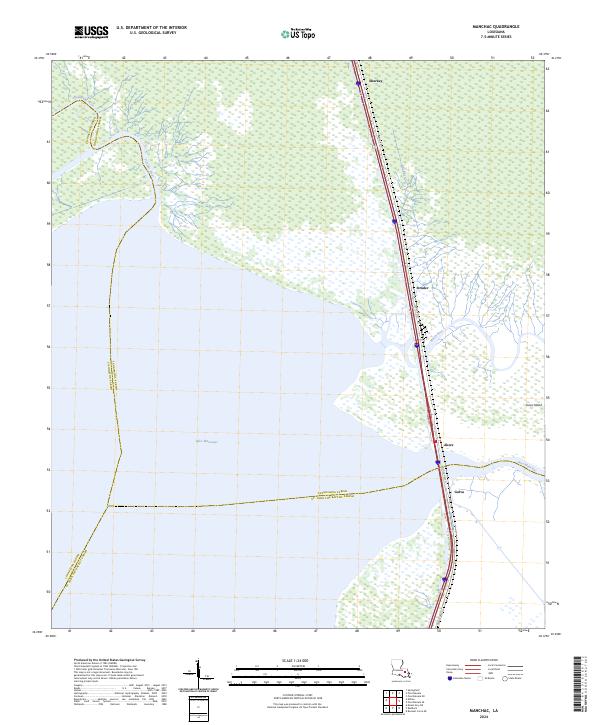
2024 Map of Manchac
USGS Topo · Published 2024About this map
Lake Maurepas dominates the lower half of this landscape, where the waters of the Tickfaw River and Natalbany River flow into the massive basin of the Maurepas swamp. This environment is defined by the narrow corridors of dry ground and the waterways that historically connected the interior parishes to the Gulf. The settlement of Akers sits prominently at the bottleneck of Pass Manchac, a vital channel linking the lake to its eastern neighbors. The map details the thin line of transit established along the swamp’s edge, including Old US Hwy 51 and the corridor through Sharkey, Strader, and Galva. This 2024 data reflects a landscape where infrastructure is constrained by the wetlands, centered on the strategic crossing at North Pass and the low-lying terrain of Jones Island.
Find a feature on this map
19 named features on this map. Tap any name to fly to it.
Don’t see what you’re looking for? This feature index may not catch every label — zoom into the map to look around manually.
Map Details
Editions of this 2024 Manchac Map
This is the sole edition of this map. No revisions or reprints were ever made.
Other maps of this area

1892 · Mount Airy
USGS Topo · 1:62,500

1892 · Bonnet Carre
USGS Topo · 1:62,500

1934 · Springfield
USGS Topo · 1:62,500

1935 · Ponchatoula
USGS Topo · 1:62,500

1936 · Ruddock
USGS Topo · 1:31,680

1936 · Bonnet Carre
USGS Topo · 1:62,500

1939 · Ponchatoula
USGS Topo · 1:62,500

1939 · Springfield
USGS Topo · 1:62,500

1946 · North of Garyville
USGS Topo · 1:31,680

1951 · Ponchatoula
USGS Topo · 1:62,500