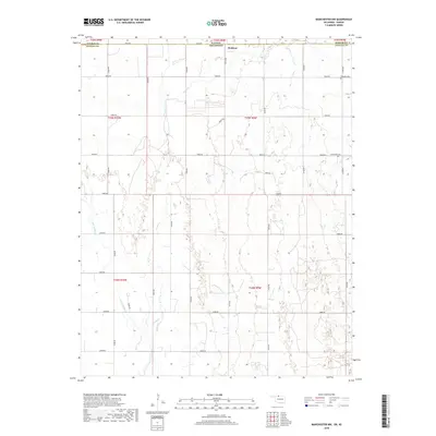
2018 Map of Manchester NW
USGS Topo · Published 2018About this map
Waldron sits along the state line in Harper County, Kansas, serving as a focal point for this rural landscape where the plains of Kansas meet the Oklahoma border. The area is defined by a grid of section-line roads, including E0010 Rd and N2740 Rd, which provide access to the dispersed farmsteads and agricultural fields that dominate the terrain. Waterways like Rush Creek and Sandy Creek wind through the region, creating natural breaks in the rectangular land divisions. For those researching local history or genealogy, the presence of Mennonite Cem and Rosedale Cem provides vital connection points to the community's early residents and their heritage. The map documents the persistent agricultural character of the region, where the intersection of Harper Co and Alfalfa Co marks a transition between two states.
Find a feature on this map
36 named features on this map. Tap any name to fly to it.
Don’t see what you’re looking for? This feature index may not catch every label — zoom into the map to look around manually.
Map Details
Editions of this 2018 Manchester NW Map
This is the sole edition of this map. No revisions or reprints were ever made.
Other maps of this area

1889 · Anthony
USGS Topo · 1:125,000

1891 · Anthony
USGS Topo · 1:125,000

1955 · Woodward
USGS Topo · 1:250,000

1955 · Pratt
USGS Topo · 1:250,000

1958 · Woodward
USGS Topo · 1:250,000

1959 · Pratt
USGS Topo · 1:250,000

1969 · Amorita
USGS Topo · 1:24,000
1969 · Manchester
USGS Topo · 1:24,000
1969 · Sand Creek
USGS Topo · 1:24,000

1969 · Manchester SW
USGS Topo · 1:24,000