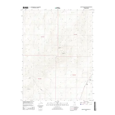
2015 Map of Manhattan Mountain
USGS Topo · Published 2015About this map
Ravenswood and the high desert landscape of central Nevada are documented here, showing the stark transition from mountain peaks to the valley floor. The map tracks the winding course of the Reese River as it passes through the eastern portion of the quadrangle, where the terrain levels into Duffy Meadows. These water sources were vital in an arid region where life and travel were dictated by the availability of springs like Steiner Spring, Meadow Spring, and Bradley Spring.
Find a feature on this map
14 named features on this map. Tap any name to fly to it.
Don’t see what you’re looking for? This feature index may not catch every label — zoom into the map to look around manually.
Map Details
Editions of this 2015 Manhattan Mountain Map
This is the sole edition of this map. No revisions or reprints were ever made.
Other maps of this area

1955 · Millett
USGS Topo · 1:250,000

1959 · Millett
USGS Topo · 1:250,000

1969 · Manhattan Mtn
USGS Topo · 1:24,000

1969 · Gilbert Creek SE
USGS Topo · 1:24,000

1969 · Joe Eason Mtn
USGS Topo · 1:24,000
1969 · Manhattan Mtn NW
USGS Topo · 1:24,000

1969 · Vigus Butte NE
USGS Topo · 1:24,000
1969 · Gilbert Creek NE
USGS Topo · 1:24,000

1969 · Vigus Butte NW
USGS Topo · 1:24,000

1969 · Mount Airy NE
USGS Topo · 1:24,000