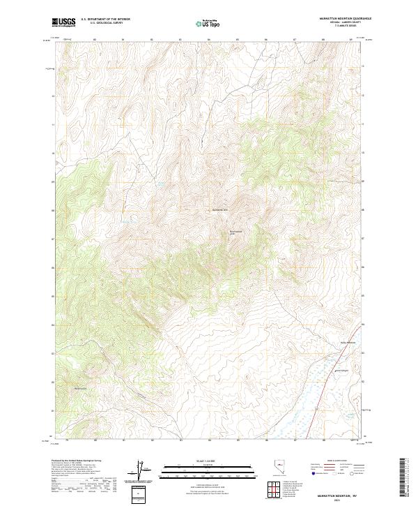
2021 Map of Manhattan Mountain
USGS Topo · Published 2021About this map
The high-elevation landscape of Manhattan Mtn and Ravenswood Peak dominates this part of Lander County, Nevada. The settlement of Ravenswood is positioned at the western base of these peaks, marking a focal point for local history and land use in the high desert. To the east, the Reese River flows through a valley defined by significant riparian landmarks like Duffy Meadows.
Find a feature on this map
13 named features on this map. Tap any name to fly to it.
Don’t see what you’re looking for? This feature index may not catch every label — zoom into the map to look around manually.
Map Details
Editions of this 2021 Manhattan Mountain Map
This is the sole edition of this map. No revisions or reprints were ever made.
Other maps of this area

1955 · Millett
USGS Topo · 1:250,000

1959 · Millett
USGS Topo · 1:250,000

1969 · Manhattan Mtn
USGS Topo · 1:24,000

1969 · Gilbert Creek SE
USGS Topo · 1:24,000

1969 · Joe Eason Mtn
USGS Topo · 1:24,000
1969 · Manhattan Mtn NW
USGS Topo · 1:24,000

1969 · Vigus Butte NE
USGS Topo · 1:24,000
1969 · Gilbert Creek NE
USGS Topo · 1:24,000

1969 · Vigus Butte NW
USGS Topo · 1:24,000

1969 · Mount Airy NE
USGS Topo · 1:24,000