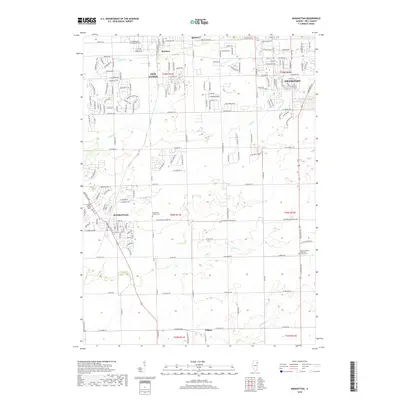
2018 Map of Manhattan
USGS Topo · Published 2018About this map
The village of Manhattan serves as a central hub in this section of Will County, situated where a grid of rural roads meets the residential expansion of the early 21st century. The landscape is defined by the headwaters of Jackson Creek and Prairie Creek, which drain the prairie lands between established settlements. To the north, the growth of New Lenox and Frankfort is evident, while the map also preserves smaller, localized identifiers such as Spencer, Brisbane, and Wilton. For those researching local heritage, the map identifies several significant landmarks, including the Saint Joseph Cemetery near the heart of Manhattan and the Manhattan Center Cemetery to the east. Farther southeast, the Green Garden Methodist Church stands near the junction of several section lines, marking a point of long-standing community gathering in this agricultural region.
Find a feature on this map
70 named features on this map. Tap any name to fly to it.
Don’t see what you’re looking for? This feature index may not catch every label — zoom into the map to look around manually.
Map Details
Editions of this 2018 Manhattan Map
This is the sole edition of this map. No revisions or reprints were ever made.
Other maps of this area

1890 · Des Plaines
USGS Topo · 1:62,500

1892 · Joliet
USGS Topo · 1:62,500

1892 · Wilmington
USGS Topo · 1:62,500

1894 · Des Plaines
USGS Topo · 1:62,500

1900 · Des Plaines
USGS Topo · 1:62,500

1901 · Des Plaines
USGS Topo · 1:62,500

1918 · Wilmington
USGS Topo · 1:62,500

1923 · Joliet
USGS Topo · 1:62,500

1929 · Tinley Park
USGS Topo · 1:24,000

1929 · Brisbane
USGS Topo · 1:24,000