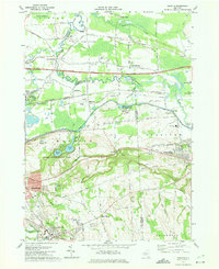
1973 Map of Manlius
USGS Topo · Published 1975About this map
Fayetteville and Manlius anchor the southwestern portion of this Onondaga County landscape, showing the suburban character of the early 1970s alongside significant historical infrastructure. The Old Erie Canal cuts a distinctive horizontal path across the center, preserved in part by Erie Canal State Park, while the New York State Thruway and Penn Central tracks facilitate modern transit nearby. To the north, the geography shifts into the lower-lying Pine Plains and Cicero Swamp, dotted with smaller communities like Kirkville and Fyler Settlement. Local heritage is visible in the placement of the Tuscarora Cem and Pine-Plains Cem. The presence of several Gravel Pits and a Filtration Plant indicates the local industrial activity and utility management required for the growing population centered around landmarks like the Fayetteville-Manlius High Sch.
Find a feature on this map
45 named features on this map. Tap any name to fly to it.
Don’t see what you’re looking for? This feature index may not catch every label — zoom into the map to look around manually.
Map Details
Editions of this 1973 Manlius Map
4 editions found
Other maps of this area

1895 · Chittenango
USGS Topo · 1:62,500

1895 · Syracuse
USGS Topo · 1:62,500

1897 · Cazenovia
USGS Topo · 1:62,500

1898 · Syracuse
USGS Topo · 1:62,500

1898 · Chittenango
USGS Topo · 1:62,500

1899 · Cazenovia
USGS Topo · 1:62,500

1900 · Tully
USGS Topo · 1:62,500

1902 · Chittenango
USGS Topo · 1:62,500

1938 · Syracuse East
USGS Topo · 1:24,000

1940 · Cicero
USGS Topo · 1:24,000