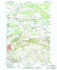
1973 Map of Manlius
USGS Topo · Published 1986About this map
The Old Erie Canal winds through the heart of this landscape, marking the transition between the glacial flatlands of the Pine Plains and the rising hills of Sullivan and Manlius. This early 1970s survey captures a geography defined by the overlapping layers of New York's transport history, where the modern New York State Thruway and the Penn Central railroad corridors parallel the historic canal route.
Find a feature on this map
58 named features on this map. Tap any name to fly to it.
Don’t see what you’re looking for? This feature index may not catch every label — zoom into the map to look around manually.
Map Details
Editions of this 1973 Manlius Map
4 editions found
Other maps of this area

1895 · Chittenango
USGS Topo · 1:62,500

1895 · Syracuse
USGS Topo · 1:62,500

1897 · Cazenovia
USGS Topo · 1:62,500

1898 · Syracuse
USGS Topo · 1:62,500

1898 · Chittenango
USGS Topo · 1:62,500

1899 · Cazenovia
USGS Topo · 1:62,500

1900 · Tully
USGS Topo · 1:62,500

1902 · Chittenango
USGS Topo · 1:62,500

1938 · Syracuse East
USGS Topo · 1:24,000

1940 · Cicero
USGS Topo · 1:24,000