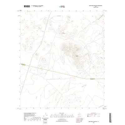
2019 Map of Mano Prieto Mountain
USGS Topo · Published 2019About this map
Puertacitas Mountains dominate the central landscape of this West Texas region, defined by the stark transition from high peaks to the expansive drainage basins that cross the terrain. The namesake Mano Prieto Mtn rises in the northern reaches, while the Jeff Davis Co Presidio Co boundary line bisects the southern half of the map, illustrating the administrative divisions of this sparsely populated desert upland. Water management and natural drainage patterns are clear through the paths of Musquiz Cr and several significant ephemeral washes. To the south, Ponder Draw and Greenlee Draw carve through the lower elevations, while Musquiz Canyon provides a distinct geological break to the northeast. Human presence is light, marked primarily by the N Mano Prieto Loop and other high-clearance access routes serving the surrounding ranchlands.
Find a feature on this map
11 named features on this map. Tap any name to fly to it.
Don’t see what you’re looking for? This feature index may not catch every label — zoom into the map to look around manually.
Map Details
Editions of this 2019 Mano Prieto Mountain Map
This is the sole edition of this map. No revisions or reprints were ever made.
Other maps of this area

1894 · Valentine
USGS Topo · 1:125,000

1894 · Fort Davis
USGS Topo · 1:125,000

1895 · Marfa
USGS Topo · 1:125,000

1895 · Alpine
USGS Topo · 1:125,000

1897 · Valentine
USGS Topo · 1:125,000

1897 · Fort Davis
USGS Topo · 1:125,000

1943 · Valentine
USGS Topo · 1:125,000

1954 · Fort Stockton
USGS Topo · 1:250,000

1958 · Fort Stockton
USGS Topo · 1:250,000

1959 · Marfa
USGS Topo · 1:250,000