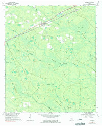
1968 Map of Manor
USGS Topo · Published 1991About this map
Manor and Glenmore serve as the primary hubs of activity in this rural stretch of South Georgia, situated along the diagonal path of the Seaboard Coast Line railroad. The landscape is defined by its complex hydrology, dominated by the winding path of Suwannee Creek and its many tributaries like Little Suwannee Creek and Cane Creek. These waterways thread through a vast mosaic of wetlands and depressions known locally as bays, including the expansive Big Bay, Hendrix Bay, and Otter Bay.
Find a feature on this map
35 named features on this map. Tap any name to fly to it.
Don’t see what you’re looking for? This feature index may not catch every label — zoom into the map to look around manually.
Map Details
Editions of this 1968 Manor Map
2 editions found

Other maps of this area

1953 · Waycross
USGS Topo · 1:250,000

1954 · Valdosta
USGS Topo · 1:250,000

1958 · Valdosta
USGS Topo · 1:250,000

1958 · Waycross
USGS Topo · 1:250,000

1959 · Valdosta
USGS Topo · 1:250,000

1966 · Cravens Island
USGS Topo · 1:24,000

1967 · Spooner
USGS Topo · 1:24,000

1967 · Waycross West
USGS Topo · 1:24,000

1967 · Pine Valley
USGS Topo · 1:24,000

1967 · Waycross SW
USGS Topo · 1:24,000