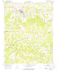
1951 Map of Mansfield
USGS Topo · Published 1977About this map
Mansfield serves as the central hub of this Ozark landscape, where the St Louis San Francisco railroad cuts a diagonal path through the northern hills. The terrain is defined by a dense network of drainage systems, including Wolf Creek, Bryant Creek, and a multitude of family-named hollows like Winkie Hollow and Shinpaugh Hollow. These features illustrate the complex topography of Pleasant Valley and Miller townships.
Find a feature on this map
55 named features on this map. Tap any name to fly to it.
Don’t see what you’re looking for? This feature index may not catch every label — zoom into the map to look around manually.
Map Details
Editions of this 1951 Mansfield Map
3 editions found
Other maps of this area

1936 · Ava
USGS Topo · 1:48,000

1937 · Buckhart
USGS Topo · 1:48,000

1942 · Ava
USGS Topo · 1:62,500

1943 · Buckhart
USGS Topo · 1:62,500

1945 · Ava
USGS Topo · 1:62,500

1945 · Harrison
USGS Topo · 1:250,000

1945 · Buckhart
USGS Topo · 1:62,500

1949 · Harrison
USGS Topo · 1:250,000

1951 · Norwood
USGS Topo · 1:24,000

1951 · Owens
USGS Topo · 1:24,000