2022 Map of Mapleton
USGS Topo · Published 2022About this map
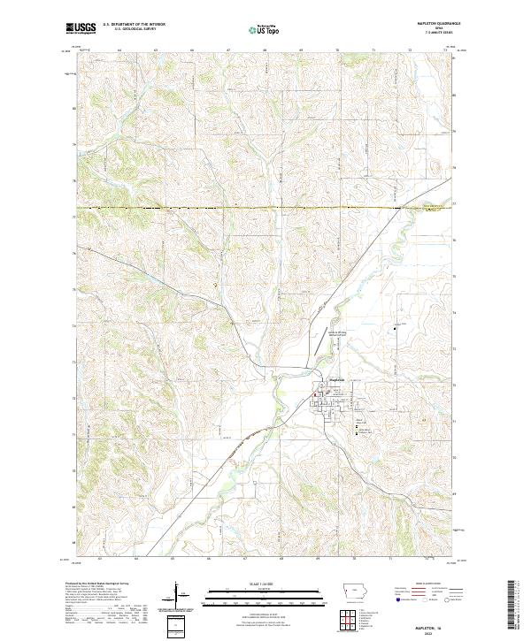
Mapleton sits at the convergence of several waterways, dominated by the winding course of the Maple River as it travels through southwestern Iowa. The town's grid is clearly defined by historical thoroughfares like Main St and Courtright St, while the surrounding landscape is marked by the irregular drainage patterns of Parnell Creek, Pumpkin Run, and Simmons Cr. This modern survey reveals a community deeply connected to its origins, with civic landmarks such as James G Whiting Memorial Field and several established burial grounds serving as focal points.
Find a feature on this map
52 named features on this map. Tap any name to fly to it.
Don’t see what you’re looking for? This feature index may not catch every label — zoom into the map to look around manually.
Map Details
Editions of this 2022 Mapleton Map
This is the sole edition of this map. No revisions or reprints were ever made.