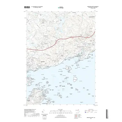
2018 Map of Marblehead North
USGS Topo · Published 2018About this map
Beverly and Salem anchor this coastal Massachusetts map, which details a landscape defined by rocky inlets, residential growth, and prominent educational institutions. Higher education campuses like Gordon College and Endicott College occupy significant terrain near the shore, while the Gordon-Conwell Theological Seminary sits further inland near Browns Hill. The shoreline itself is a complex network of points and coves, from Beverly Cove to the narrow peninsula of Marblehead Neck.
Find a feature on this map
292 named features on this map. Tap any name to fly to it.
Don’t see what you’re looking for? This feature index may not catch every label — zoom into the map to look around manually.
Map Details
Editions of this 2018 Marblehead North Map
This is the sole edition of this map. No revisions or reprints were ever made.
Other maps of this area

1886 · Gloucester
USGS Topo · 1:62,500

1888 · Gloucester
USGS Topo · 1:62,500

1888 · Salem
USGS Topo · 1:62,500

1892 · Boston Bay
USGS Topo · 1:62,500

1893 · Salem
USGS Topo · 1:62,500

1893 · Gloucester
USGS Topo · 1:62,500

1903 · Boston Bay
USGS Topo · 1:62,500

1917 · Salem
USGS Topo · 1:62,500

1918 · Gloucester
USGS Topo · 1:62,500

1919 · Salem
USGS Topo · 1:62,500