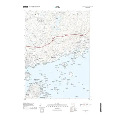
2021 Map of Marblehead North
USGS Topo · Published 2021About this map
Salem and Beverly anchor this coastal Massachusetts landscape, where the rugged North Shore meets a labyrinth of tidal channels and rocky islands. The map highlights the area's rich maritime and institutional history, featuring the historic grounds of Old Burial Hill Cem and the defensive site at Fort Pickering. To the north, the terrain transitions from the busy Manchester Channel to the wooded hills of Wenham Neck, punctuated by higher elevations like Sagamore Hill and Morse Hill. This area is characterized by a dense concentration of educational landmarks, including Gordon College and Endicott College, alongside prestigious coastal enclaves like Prides Crossing and Manchester-by-the-Sea. The intricate shoreline, from the sands of Singing Beach to the rocky outcrops of Marblehead Neck, illustrates the complex relationship between the region's granite geology and the Atlantic shelf.
Find a feature on this map
253 named features on this map. Tap any name to fly to it.
Don’t see what you’re looking for? This feature index may not catch every label — zoom into the map to look around manually.
Map Details
Editions of this 2021 Marblehead North Map
This is the sole edition of this map. No revisions or reprints were ever made.
Other maps of this area

1886 · Gloucester
USGS Topo · 1:62,500

1888 · Gloucester
USGS Topo · 1:62,500

1888 · Salem
USGS Topo · 1:62,500

1892 · Boston Bay
USGS Topo · 1:62,500

1893 · Salem
USGS Topo · 1:62,500

1893 · Gloucester
USGS Topo · 1:62,500

1903 · Boston Bay
USGS Topo · 1:62,500

1917 · Salem
USGS Topo · 1:62,500

1918 · Gloucester
USGS Topo · 1:62,500

1919 · Salem
USGS Topo · 1:62,500