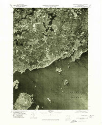
1977 Map of Marblehead North
USGS Topo · Published 1980About this map
Marblehead and Salem define the southern coastline of this orthophotoquad, where the jagged North Shore meets Massachusetts Bay. Prepared from aerial photography taken in the spring of 1977, this document provides a direct visual record of the late-century coastal development and the dense residential patterns of Beverly and Manchester. Inland, the landscape transitions to the more open spaces of Centerville and South Hamilton, where the Miles River cuts through the terrain. Unlike traditional line-drawn maps, this aerial perspective allows for a detailed study of land use, forest cover, and the exact footprints of the maritime communities that have long defined the geography of Essex County. Researchers can observe the interplay of natural harbors and modern transportation corridors as they existed decades ago.
Find a feature on this map
9 named features on this map. Tap any name to fly to it.
Don’t see what you’re looking for? This feature index may not catch every label — zoom into the map to look around manually.
Map Details
Editions of this 1977 Marblehead North Map
This is the sole edition of this map. No revisions or reprints were ever made.
Other maps of this area

1886 · Gloucester
USGS Topo · 1:62,500

1888 · Gloucester
USGS Topo · 1:62,500

1888 · Salem
USGS Topo · 1:62,500

1892 · Boston Bay
USGS Topo · 1:62,500

1893 · Salem
USGS Topo · 1:62,500

1893 · Gloucester
USGS Topo · 1:62,500

1903 · Boston Bay
USGS Topo · 1:62,500

1917 · Salem
USGS Topo · 1:62,500

1918 · Gloucester
USGS Topo · 1:62,500

1919 · Salem
USGS Topo · 1:62,500