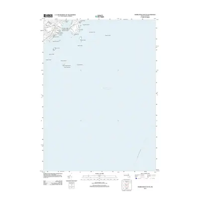
2012 Map of Marblehead South
USGS Topo · Published 2012About this map
Devereux Beach and the narrow strip of The Bridge Causeway define the coastal character of this shoreline just after the turn of the twenty-first century. This portion of the Massachusetts coast is dominated by its relationship with the Atlantic Ocean, where hazardous offshore features like Roaring Bull, Tinkers Ledge, and the Southwest Breakers define the maritime approach. The map captures the suburban residential layout of the Marblehead Neck area, with named roads such as Ocean Ave and Harbor Ave tracing the rocky perimeter. To the southeast, the path of the Boston - Gloucester Ferry Crossing cuts across the open water, serving as a reminder of the enduring transit connections between North Shore communities. From the small curve of Ladys Cove to the prominent heights of Skinner Head, the topography reflects a landscape shaped by both private development and public shoreline access.
Find a feature on this map
43 named features on this map. Tap any name to fly to it.
Don’t see what you’re looking for? This feature index may not catch every label — zoom into the map to look around manually.
Map Details
Editions of this 2012 Marblehead South Map
This is the sole edition of this map. No revisions or reprints were ever made.
Other maps of this area

1886 · Gloucester
USGS Topo · 1:62,500

1888 · Gloucester
USGS Topo · 1:62,500

1888 · Salem
USGS Topo · 1:62,500

1892 · Boston Bay
USGS Topo · 1:62,500

1893 · Salem
USGS Topo · 1:62,500

1893 · Gloucester
USGS Topo · 1:62,500

1903 · Boston Bay
USGS Topo · 1:62,500

1917 · Salem
USGS Topo · 1:62,500

1918 · Gloucester
USGS Topo · 1:62,500

1919 · Salem
USGS Topo · 1:62,500