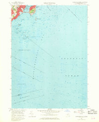
1956 Map of Marblehead South
USGS Topo · Published 1968About this map
The rocky coastline and maritime heritage of the North Shore are captured here during the mid-1950s. The dense residential and educational landscape of Marblehead is centered around its protected Marblehead Harbor, featuring the Marblehead Yacht Club and local landmarks like the Star of the Sea School and Tower School. The narrow Causeway provides a vital link to the peninsula of Marblehead Neck, where coastal features like Castle Rock and Flying Point meet the open waters of the Atlantic Ocean.
Find a feature on this map
39 named features on this map. Tap any name to fly to it.
Don’t see what you’re looking for? This feature index may not catch every label — zoom into the map to look around manually.
Map Details
Editions of this 1956 Marblehead South Map
2 editions found

Other maps of this area

1886 · Gloucester
USGS Topo · 1:62,500

1888 · Gloucester
USGS Topo · 1:62,500

1888 · Salem
USGS Topo · 1:62,500

1892 · Boston Bay
USGS Topo · 1:62,500

1893 · Salem
USGS Topo · 1:62,500

1893 · Gloucester
USGS Topo · 1:62,500

1903 · Boston Bay
USGS Topo · 1:62,500

1917 · Salem
USGS Topo · 1:62,500

1918 · Gloucester
USGS Topo · 1:62,500

1919 · Salem
USGS Topo · 1:62,500