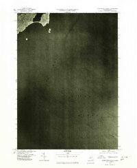
1977 Map of Marblehead South
USGS Topo · Published 1980About this map
Marblehead sits along the northern edge of this orthophotoquad, which captures the coastal geography of the Massachusetts shore as it appeared in the late 1970s. The majority of the sheet is dominated by the expanse of Massachusetts Bay and the Atlantic Ocean, providing a specialized aerial perspective of the shoreline and maritime approaches. Prepared from aerial photography taken on April 1, 1977, this survey by the Department of the Interior and the Commonwealth of Massachusetts Department of Public Works offers a clear view of the town's dense residential footprint and its relationship to the harbor. The visual detail emphasizes the rugged coastline and small offshore rocky outcrops typical of this stretch of the Atlantic coast.
Find a feature on this map
3 named features on this map. Tap any name to fly to it.
Don’t see what you’re looking for? This feature index may not catch every label — zoom into the map to look around manually.
Map Details
Editions of this 1977 Marblehead South Map
This is the sole edition of this map. No revisions or reprints were ever made.
Other maps of this area

1886 · Gloucester
USGS Topo · 1:62,500

1888 · Gloucester
USGS Topo · 1:62,500

1888 · Salem
USGS Topo · 1:62,500

1892 · Boston Bay
USGS Topo · 1:62,500

1893 · Salem
USGS Topo · 1:62,500

1893 · Gloucester
USGS Topo · 1:62,500

1903 · Boston Bay
USGS Topo · 1:62,500

1917 · Salem
USGS Topo · 1:62,500

1918 · Gloucester
USGS Topo · 1:62,500

1919 · Salem
USGS Topo · 1:62,500