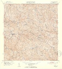
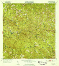
1952 Map of Maricao
USGS Topo · Published 1953About this map
The town of Maricao serves as the focal point of this 1952 topographic study, situated at the junction of several municipal boundaries including Municipio de Las Marias and Municipio de San German. The landscape is defined by an extensive network of haciendas, such as Hacienda Lealtad, Hacienda Ballester, and Hacienda Monserrate, which reflect the region's agricultural heritage and complex land division in the mid-20th century.
Find a feature on this map
101 named features on this map. Tap any name to fly to it.
Don’t see what you’re looking for? This feature index may not catch every label — zoom into the map to look around manually.
Map Details
Editions of this 1952 Maricao Map
2 editions found
Other maps of this area

1937 · San German
USGS Topo · 1:25,000

1937 · Sabana Grande
USGS Topo · 1:25,000

1938 · Alto Sano
USGS Topo · 1:20,000

1938 · San Sebastian
USGS Topo · 1:20,000

1941 · San German
USGS Topo · 1:30,000

1941 · San Sebastian
USGS Topo · 1:30,000

1941 · Sabana Grande
USGS Topo · 1:30,000

1941 · Rosario
USGS Topo · 1:30,000

1942 · Central La Plata
USGS Topo · 1:30,000

1942 · Rosario
USGS Topo · 1:30,000