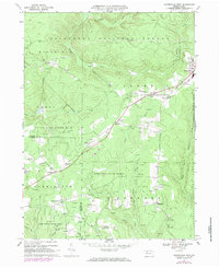
1967 Map of Marienville West
USGS Topo · Published 1984About this map
The Baltimore and Ohio railroad corridor anchors this landscape, cutting southwest through the heart of the Pennsylvania forest. Small settlements like Marienville, Roses, and Vowinckel dot the rail line, while more secluded clusters like Redclyffe and Muzette are found deeper in the timbered hills. The map highlights the intersection of industry and recreation, showing numerous gas wells and a Strip Mine interspersed with the boundaries of Allegheny National Forest, Kittanning State Forest, and Cook Forest State Park.
Find a feature on this map
41 named features on this map. Tap any name to fly to it.
Don’t see what you’re looking for? This feature index may not catch every label — zoom into the map to look around manually.
Map Details
Editions of this 1967 Marienville West Map
Other maps of this area

1918 · Loleta
USGS Topo · 1:62,500

1922 · Tionesta
USGS Topo · 1:62,500

1924 · Tionesta
USGS Topo · 1:62,500

1927 · Tidioute
USGS Topo · 1:48,000

1930 · Tidioute
USGS Topo · 1:62,500

1935 · Sheffield
USGS Topo · 1:48,000

1936 · Marienville
USGS Topo · 1:48,000

1941 · Sheffield
USGS Topo · 1:62,500

1941 · Marienville
USGS Topo · 1:62,500

1946 · Tionesta
USGS Topo · 1:62,500