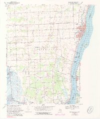
1968 Map of Marine City
USGS Topo · Published 1974About this map
The St Clair River defines the eastern edge of this Michigan landscape, serving as an international boundary between United States Canada and marking the industrial and recreational corridor of St. Clair County. The city of Marine City stands as a focal point, showing a developed riverfront with U S Customs, City Hall, and the Port Huron and Detroit railroad line. To the south, the extensive marshes and wetlands around Bouvier Bay and Pearl Beach contrast with the inland agricultural grid, where roads like Plank Road and Marine City Highway connect small settlements like Starville and Beaverdam.
Find a feature on this map
75 named features on this map. Tap any name to fly to it.
Don’t see what you’re looking for? This feature index may not catch every label — zoom into the map to look around manually.
Map Details
Editions of this 1968 Marine City Map
4 editions found
Other maps of this area

1912 · Port Huron
USGS Topo · 1:62,500

1914 · Algonac
USGS Topo · 1:62,500

1928 · Hicky
USGS Topo · 1:62,500

1929 · Port Huron
USGS Topo · 1:62,500

1936 · St. Clair
USGS Topo · 1:31,680

1936 · Rattle Run
USGS Topo · 1:31,680

1936 · New Baltimore
USGS Topo · 1:31,680

1936 · Algonac
USGS Topo · 1:31,680

1939 · New Baltimore
USGS Topo · 1:24,000

1939 · Adair
USGS Topo · 1:24,000