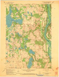
1967 Map of Marine on St Croix
USGS Topo · Published 1969About this map
The St Croix River defines the eastern boundary of this mid-century landscape, separating Minnesota from Wisconsin along a corridor of wooded bluffs and river islands like Greenburg Island. The village of Marine on St Croix serves as a focal point, showing a established grid adjacent to the river, while smaller settlements like Copas and Otisville dot the northern reaches. This 1967 revision highlights a transition toward recreation and preservation, evidenced by the expansive William O'Brien State Park and the Amherst H Wilder Day Camp Area.
Find a feature on this map
40 named features on this map. Tap any name to fly to it.
Don’t see what you’re looking for? This feature index may not catch every label — zoom into the map to look around manually.
Map Details
Editions of this 1967 Marine on St Croix Map
3 editions found
Other maps of this area

1900 · St Croix Dalles
USGS Topo · 1:62,500

1901 · St Croix Dalles
USGS Topo · 1:62,500

1948 · New Richmond
USGS Topo · 1:62,500

1948 · Stillwater
USGS Topo · 1:62,500

1949 · New Richmond
USGS Topo · 1:62,500

1949 · Stillwater
USGS Topo · 1:62,500

1951 · White Bear Lake East
USGS Topo · 1:24,000

1951 · Stillwater
USGS Topo · 1:24,000

1953 · Stillwater
USGS Topo · 1:250,000

1954 · Hugo
USGS Topo · 1:24,000