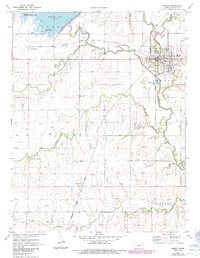
1971 Map of Marion
USGS Topo · Published 1985About this map
Marion stands as the primary hub of activity in this central Kansas landscape, situated at the junction of the North Cottonwood River and the South Cottonwood River. The town's industrial and transport identity is defined by the crossing of the Oklahoma Kansas and Texas and the Atchison Topeka and Santa Fe railroads, which served the local agricultural economy. To the northwest, the expansive waters of Marion Lake and its associated Marion Lake National Hunting Area dominate the terrain, reflecting the mid-century development of flood control and recreation. Smaller rural communities like Canada and Aulne dot the outskirts, while family history is etched into the landscape at sites like Canada Cem and Claney Cem. The map also captures the rural spiritual life of the era through landmarks such as Our Lady of Perpetual Help Ch.
Find a feature on this map
34 named features on this map. Tap any name to fly to it.
Don’t see what you’re looking for? This feature index may not catch every label — zoom into the map to look around manually.
Map Details
Editions of this 1971 Marion Map
2 editions found
Other maps of this area

1889 · Newton
USGS Topo · 1:125,000

1894 · Newton
USGS Topo · 1:125,000

1898 · Cottonwood Falls
USGS Topo · 1:125,000

1955 · Hutchinson
USGS Topo · 1:250,000

1957 · Peabody NW
USGS Topo · 1:24,000

1957 · Florence
USGS Topo · 1:24,000

1957 · Lincolnville SW
USGS Topo · 1:24,000

1957 · Peabody
USGS Topo · 1:24,000

1959 · Hutchinson
USGS Topo · 1:250,000

1971 · Durham
USGS Topo · 1:24,000