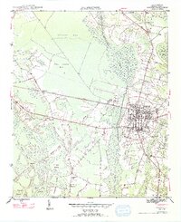
1947 Map of Marion
USGS Topo · Published 1947About this map
Marion serves as the focal point of this 1940s survey, showing the city's concentrated grid bisected by the Atlantic Coast Line railroad. Outside the town center, the landscape is defined by an intricate network of wetlands and islands, including Johnson Swamp and the sprawling Singletary Islands. The rural area is dotted with small community landmarks such as Singletary Ch and Springville Sch, providing essential coordinates for genealogists tracing local families.
Find a feature on this map
37 named features on this map. Tap any name to fly to it.
Don’t see what you’re looking for? This feature index may not catch every label — zoom into the map to look around manually.
Map Details
Editions of this 1947 Marion Map
3 editions found
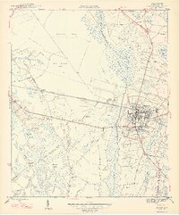
Other maps of this area

1940 · Florence East
USGS Topo · 1:62,500

1943 · Gum Swamp
USGS Topo · 1:62,500

1945 · Florence East
USGS Topo · 1:62,500

1946 · Mullins
USGS Topo · 1:24,000

1947 · Friendship
USGS Topo · 1:24,000

1947 · Marion
USGS Topo · 1:24,000

1947 · Centenary
USGS Topo · 1:24,000

1947 · Mullins
USGS Topo · 1:24,000

1953 · Florence
USGS Topo · 1:250,000

1954 · Florence
USGS Topo · 1:250,000