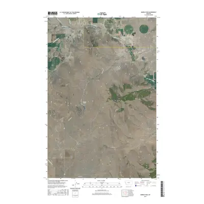
2017 Map of Markle Pass
USGS Topo · Published 2017About this map
Markle Pass serves as a geographic focus in this section of Northwest Montana, where the Salish Mountains meet the northern edge of the Camas Prairie Basin. The landscape is defined by its dramatic elevation changes, rising from the basin floor toward Schmitz Mtn and the surrounding peaks. A network of rural roads, including Little Bitterroot Rd and Wilks Gulch Rd, connects the scattered water features of the region, from the Little Bitterroot River in the east to the Schmitz Lakes tucked within the central slopes.
Find a feature on this map
33 named features on this map. Tap any name to fly to it.
Don’t see what you’re looking for? This feature index may not catch every label — zoom into the map to look around manually.
Map Details
Editions of this 2017 Markle Pass Map
This is the sole edition of this map. No revisions or reprints were ever made.
Other maps of this area

1920 · Flathead Lake
USGS Topo · 1:125,000

1956 · Wallace
USGS Topo · 1:250,000

1959 · Perma
USGS Topo · 1:62,500

1960 · Wallace
USGS Topo · 1:250,000

1964 · Melton Ranch
USGS Topo · 1:24,000

1964 · Markle Pass
USGS Topo · 1:24,000

1964 · Lonepine
USGS Topo · 1:24,000

1964 · Hot Springs
USGS Topo · 1:24,000
1964 · Hot Springs NE
USGS Topo · 1:24,000

1965 · Oliver Point
USGS Topo · 1:24,000