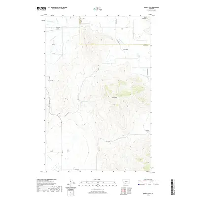
2020 Map of Markle Pass
USGS Topo · Published 2020About this map
Markle Pass and the surrounding peaks of the Salish Mountains define this landscape on the border of Sanders and Lake counties. In the northern reaches, the Hot Springs Airport sits near the confluence of Hot Springs Cr and Garden Cr, serving the high-altitude valley floor. The terrain transitions from the rugged heights of Schmitz Mtn down into the expansive Camas Prairie Basin to the south. This area is characterized by its complex drainage network, where the Little Bitterroot River and Warm Springs Cr wind through the hills. Local history is anchored by the Markle Cem, located west of the pass. The map also documents a series of distinct natural features, including the Schmitz Lakes and significant seasonal drainages like Big Gulch and Wilks Gulch.
Find a feature on this map
35 named features on this map. Tap any name to fly to it.
Don’t see what you’re looking for? This feature index may not catch every label — zoom into the map to look around manually.
Map Details
Editions of this 2020 Markle Pass Map
This is the sole edition of this map. No revisions or reprints were ever made.
Other maps of this area

1920 · Flathead Lake
USGS Topo · 1:125,000

1956 · Wallace
USGS Topo · 1:250,000

1959 · Perma
USGS Topo · 1:62,500

1960 · Wallace
USGS Topo · 1:250,000

1964 · Melton Ranch
USGS Topo · 1:24,000

1964 · Markle Pass
USGS Topo · 1:24,000

1964 · Lonepine
USGS Topo · 1:24,000

1964 · Hot Springs
USGS Topo · 1:24,000
1964 · Hot Springs NE
USGS Topo · 1:24,000

1965 · Oliver Point
USGS Topo · 1:24,000