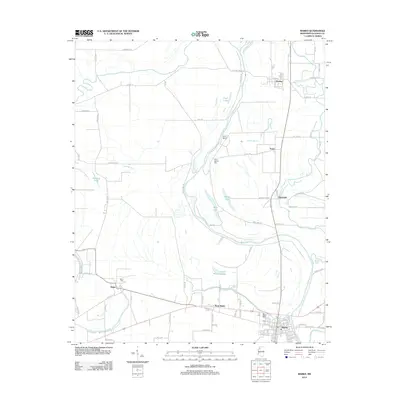
2012 Map of Marks
USGS Topo · Published 2012About this map
Marks and its neighboring delta settlements are defined by an intricate network of waterways and oxbow remnants. The Coldwater River snakes across the northern and eastern reaches of the landscape, feeding a system of bayous and chutes that once governed the agricultural development of the region. Local heritage is grounded in landmarks like Posey Mound and the adjacent Posey Mound Cem, alongside the Belen Cem situated near the historic crossing at Belen. This 2012 survey illustrates the transition from the river-dependent agriculture of the past to the modern road grids that now connect Darling, Hinchcliff, and Essex. The presence of features like Whiting Chute and Bear Lake highlight the complex hydrology of the Mississippi Delta, while the concentrated development in West Marks shows the expansion of the county seat away from its traditional core.
Find a feature on this map
83 named features on this map. Tap any name to fly to it.
Don’t see what you’re looking for? This feature index may not catch every label — zoom into the map to look around manually.
Map Details
Editions of this 2012 Marks Map
This is the sole edition of this map. No revisions or reprints were ever made.
Other maps of this area

1908 · Lula
USGS Topo · 1:24,000

1908 · Jonestown
USGS Topo · 1:24,000

1910 · Jonestown
USGS Topo · 1:31,680

1912 · Lula
USGS Topo · 1:31,680

1932 · Sledge
USGS Topo · 1:48,000

1932 · Tutwiler
USGS Topo · 1:48,000

1932 · Marks
USGS Topo · 1:48,000

1935 · Crowder
USGS Topo · 1:62,500

1935 · Marks
USGS Topo · 1:62,500

1935 · Tutwiler
USGS Topo · 1:62,500