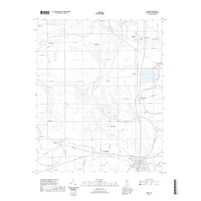
2020 Map of Marks
USGS Topo · Published 2020About this map
The Quitman County Courthouse stands as the central landmark of Marks, Mississippi, situated within a landscape defined by the winding course of the Coldwater River. This 2020 survey documents the Delta region's complex hydrology, where Cassidy Bayou, Wilson Bayou, and Burrell Bayou weave between established agricultural tracks. The mapping reveals a pattern of scattered settlements and rural crossroads, from Darling in the north to the community of Belen in the west.
Find a feature on this map
90 named features on this map. Tap any name to fly to it.
Don’t see what you’re looking for? This feature index may not catch every label — zoom into the map to look around manually.
Map Details
Editions of this 2020 Marks Map
This is the sole edition of this map. No revisions or reprints were ever made.
Other maps of this area

1908 · Lula
USGS Topo · 1:24,000

1908 · Jonestown
USGS Topo · 1:24,000

1910 · Jonestown
USGS Topo · 1:31,680

1912 · Lula
USGS Topo · 1:31,680

1932 · Sledge
USGS Topo · 1:48,000

1932 · Tutwiler
USGS Topo · 1:48,000

1932 · Marks
USGS Topo · 1:48,000

1935 · Crowder
USGS Topo · 1:62,500

1935 · Marks
USGS Topo · 1:62,500

1935 · Tutwiler
USGS Topo · 1:62,500