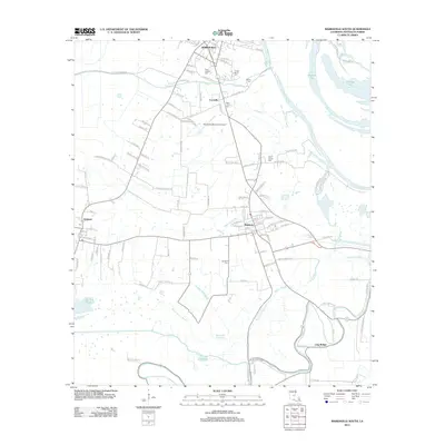
2012 Map of Marksville South
USGS Topo · Published 2012About this map
Marksville and its southern neighboring communities in Avoyelles Parish are defined by the complex hydrology of the Mississippi River floodplain, where bayous and coulees dictate the patterns of settlement. The landscape is a network of winding waterways like Coulee des Grues, Bayou Grande Ecore, and La Vieille Riviere, interspersed with low-lying basins such as Lac aux Perles. Culturally, the map highlights significant local heritage sites, including the Tunica-Biloxi Cem and Saint Joseph Cem. Roads like Little California Rd and King Arthur Dr serve the residential clusters of Cocoville, Hessmer, and Mansura, while the economy is tied to the local aviation at Marksville Municipal Airport. The interaction between the established towns and the riparian environment of Bayou des Glaises reflects a region deeply adapted to its alluvial surroundings.
Find a feature on this map
110 named features on this map. Tap any name to fly to it.
Don’t see what you’re looking for? This feature index may not catch every label — zoom into the map to look around manually.
Map Details
Editions of this 2012 Marksville South Map
This is the sole edition of this map. No revisions or reprints were ever made.
Other maps of this area

1940 · Marksville
USGS Topo · 1:62,500

1941 · Voorhies
USGS Topo · 1:62,500

1948 · Bunkie
USGS Topo · 1:62,500

1952 · Lake Charles
USGS Topo · 1:250,000

1953 · Alexandria
USGS Topo · 1:250,000

1953 · Natchez
USGS Topo · 1:250,000

1954 · Lake Charles
USGS Topo · 1:250,000

1954 · Baton Rouge
USGS Topo · 1:250,000

1955 · Odenburg
USGS Topo · 1:62,500

1955 · Alexandria
USGS Topo · 1:250,000