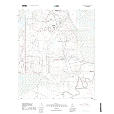
2020 Map of Marksville South
USGS Topo · Published 2020About this map
The Tunica-Biloxi Indian Reservation and the city of Marksville anchor the northern reaches of this Louisiana landscape, where the flat alluvial plains are defined by an intricate network of bayous and coulees. The terrain is dominated by the meandering paths of Coulee des Grues and La Vieille Riviere, illustrating the historical hydrological patterns of Avoyelles Parish. Settlement is concentrated along the higher ground of the prairie, following established road networks like Curry Moreau Rd and Lanson Bordelon Rd. Local history is preserved in numerous family and community sites, including the Tunica-Biloxi Cem, Baibry Cem, and Jerusalem Cem. The map documents the region's mid-sized hubs such as Mansura and Hessmer, along with the industrial and aviation footprint of the Marksville Municipal Airport.
Find a feature on this map
112 named features on this map. Tap any name to fly to it.
Don’t see what you’re looking for? This feature index may not catch every label — zoom into the map to look around manually.
Map Details
Editions of this 2020 Marksville South Map
This is the sole edition of this map. No revisions or reprints were ever made.
Other maps of this area

1940 · Marksville
USGS Topo · 1:62,500

1941 · Voorhies
USGS Topo · 1:62,500

1948 · Bunkie
USGS Topo · 1:62,500

1952 · Lake Charles
USGS Topo · 1:250,000

1953 · Alexandria
USGS Topo · 1:250,000

1953 · Natchez
USGS Topo · 1:250,000

1954 · Lake Charles
USGS Topo · 1:250,000

1954 · Baton Rouge
USGS Topo · 1:250,000

1955 · Odenburg
USGS Topo · 1:62,500

1955 · Alexandria
USGS Topo · 1:250,000