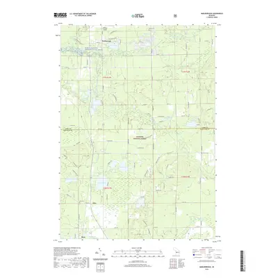
2019 Map of Marlborough
USGS Topo · Published 2019About this map
The Pere Marquette Wild and Scenic River winds through the northern portion of this landscape, anchoring a region defined by its dense network of glacial lakes and wetlands. The settlement of Marlborough sits near the river's path, while the southern reaches are dominated by the Manistee National Forest. This 2019 survey documents a landscape where traditional transit and recreation intersect, notably at the Baldwin Municipal Airport and along various forest roads. Researchers can trace local heritage through several small burial grounds, including Oaklawn Cem and Lilley Cem, which serve as quiet landmarks for the communities of Lilley and Bitely. The map details numerous water bodies such as Pickerel Lake and the curiously named Railroad Lake, illustrating the post-glacial topography that has shaped Newaygo and Lake Counties. This area remains a hybrid of protected federal wilderness and small-town Michigan life, linked by the Middle Br Pere Marquette River.
Find a feature on this map
79 named features on this map. Tap any name to fly to it.
Don’t see what you’re looking for? This feature index may not catch every label — zoom into the map to look around manually.
Map Details
Editions of this 2019 Marlborough Map
This is the sole edition of this map. No revisions or reprints were ever made.
Other maps of this area

1931 · Baldwin NW
USGS Topo · 1:31,680

1931 · Baldwin NE
USGS Topo · 1:31,680

1932 · Chase NW
USGS Topo · 1:31,680

1954 · Midland
USGS Topo · 1:250,000

1958 · Midland
USGS Topo · 1:250,000

1958 · Woodville
USGS Topo · 1:62,500

1959 · Midland
USGS Topo · 1:250,000

1959 · Reed City
USGS Topo · 1:62,500

1959 · Baldwin
USGS Topo · 1:62,500

1959 · White Cloud
USGS Topo · 1:62,500