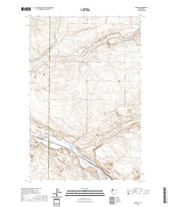
2023 Map of Marlin
USGS Topo · Published 2023About this map
Krupp and Marlin anchor the southern portion of this landscape along the Lincoln and Grant county line. The geography is defined by the east-west passage of Crab Creek, which cuts through the plateau alongside Peterson Mende Rd. To the north, the Canniwai Valley serves as another primary drainage corridor, carrying the waters of Canniwai Creek through a series of draws and hollows.
Find a feature on this map
33 named features on this map. Tap any name to fly to it.
Don’t see what you’re looking for? This feature index may not catch every label — zoom into the map to look around manually.
Map Details
Editions of this 2023 Marlin Map
This is the sole edition of this map. No revisions or reprints were ever made.
Other maps of this area

1953 · Ritzville
USGS Topo · 1:250,000

1956 · Wilson Creek SE
USGS Topo · 1:24,000

1956 · Wilson Creek
USGS Topo · 1:62,500

1959 · Ritzville
USGS Topo · 1:250,000

1965 · Ritzville
USGS Topo · 1:250,000

1968 · Marlin SW
USGS Topo · 1:24,000

1968 · Irby
USGS Topo · 1:24,000

1968 · Marlin
USGS Topo · 1:24,000

1968 · Hartline SE
USGS Topo · 1:24,000

1968 · Sullivan Lake
USGS Topo · 1:24,000