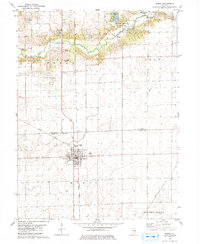
1979 Map of Maroa
USGS Topo · Published 1980About this map
Maroa serves as the central hub for this Central Illinois landscape, situated at the intersection of the Illinois Central Gulf railroad and regional roadways. The city’s residential grid is clearly defined, featuring local institutions such as the Maroa Forsyth High Sch and the Maroa Cem. North of the town center, the terrain is shaped by the winding course of Salt Creek, which flows through Weldon Springs State Park, a prominent recreational area located just across the county line in De Witt County.
Find a feature on this map
22 named features on this map. Tap any name to fly to it.
Don’t see what you’re looking for? This feature index may not catch every label — zoom into the map to look around manually.
Map Details
Editions of this 1979 Maroa Map
2 editions found
Other maps of this area

1929 · Decatur
USGS Topo · 1:62,500

1933 · Decatur
USGS Topo · 1:62,500

1954 · Niantic
USGS Topo · 1:62,500

1957 · Kenney
USGS Topo · 1:62,500

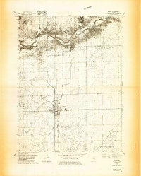
1957 · Maroa
USGS Topo · 1:62,500

1958 · Peoria
USGS Topo · 1:250,000

1958 · Decatur
USGS Topo · 1:250,000

1961 · Peoria
USGS Topo · 1:250,000

1961 · Decatur
USGS Topo · 1:250,000

1963 · Peoria
USGS Topo · 1:250,000